Heritage trails
This page offers three routes for visitors to the Kakatiya monuments of Warangal and the country around it. Each stop links to its own page on this website.
The points to look for at each stop are sentences from that page, with the same sources. The page adds no new facts, and it gives no travel times, opening hours or entry fees.
The routes · 1
Warangal Fort
From the four gateways of the Swayambhu temple to the walls and the Shivanagar stepwell
8 stops · about 3.7 km in straight lines from the first stop to the last
Warangal Fort was the Kakatiya capital at Orugallu. The fort has an outer earthen wall and an inner stone wall, and the Swayambhu temple stood at its centre.ASI 1900
This route starts at the four gateways of the Swayambhu temple and visits the buildings near them. The route then goes west through the stone wall and the earthen wall, and ends at the Shivanagar stepwell outside the fort.
The positions of several stops inside the fort are read from written descriptions, as on the fort plan of this website. The map draws these stops as hollow circles.
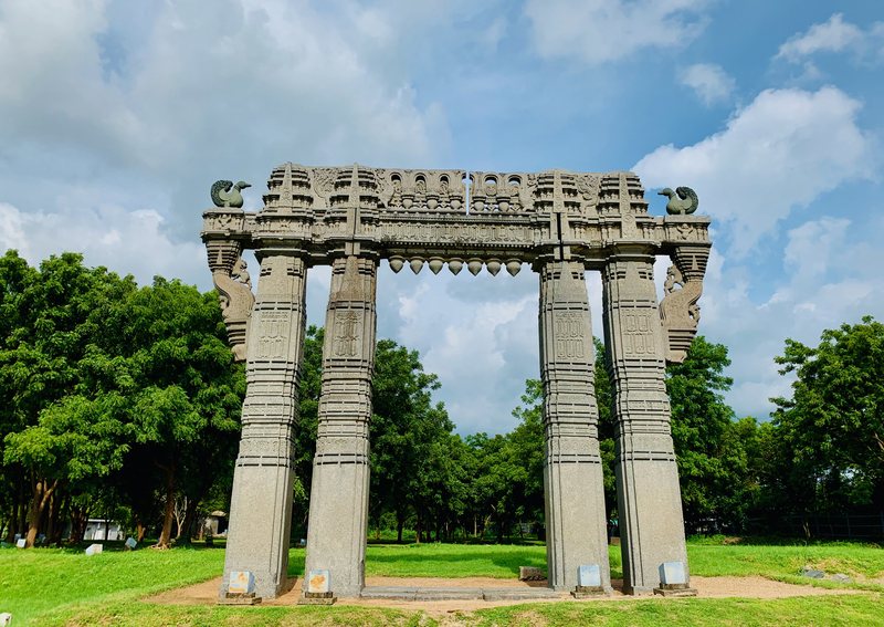
Photo: Ms Sarah Welch, via Wikimedia Commons · CC0 · 2019 What to look for
- The Census volume describes the gateways as all of one pattern, made of grey granite. A swan sits at each end of the arch.Census 1961, Fairs and Festivals: Warangal
- Murthy also notes a carving of Padmavati, the yakshi of the Jain teacher Parsvanatha, on the south side of the southern gateway.Gopalakrishna Murthy 1964
- Two of the gateways carry short inscriptions about the poet Narasimha. The record on the southern gateway lists his works, among them a Kakatiya-charitra in eight cantos, which he is said to have written in a single day.Epigraphia Telanganica 2023Parabrahma Sastry 1975 (thesis)
- In 1991-92 the Archaeological Survey of India arranged the loose sculptures and scattered architectural pieces of the Swayambhu temple complex like an open-air museum. The review gives the purpose as preventing damage and giving visitors free access.IAR 1991-92
Condition recorded on this website: The four gateways stand. The temple itself is gone, and its carved blocks lie in rows on the lawn between the gateways, as photographs of 2019 show.
2. Konda Masjid
approximate position
About 250 m from stop 1 in a straight line. The road is longer. One or both of these positions are approximate.
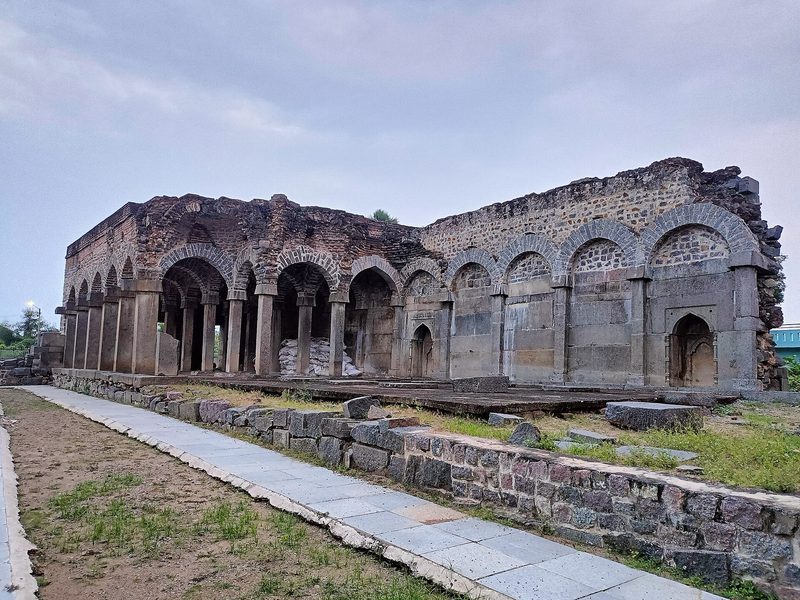
Photo: Tarunsamanta, via Wikimedia Commons · CC BY-SA 4.0 What to look for
- The 1900 survey lists Konda Masjid as an old, partly ruined mosque within the fort walls.ASI 1900
- The HRIDAY leaflet places a mosque a few yards south of the Ekasila rock. That mosque may be Konda Masjid.HRIDAY Warangal leaflet
- India's 2019 reply to UNESCO states that Konda Masjid was built partly with stones taken from the ruined Swayambhu temple.UNESCO additional information 2019
The map position is read from a written description, as on the plan of Warangal Fort on this website. The position is approximate.
Condition recorded on this website: Partly ruined as of 1900.
3. Sambhuni Gudi· Swayambhu Temple, Warangal Fort
approximate position
About 300 m from stop 2 in a straight line. The road is longer. One or both of these positions are approximate.
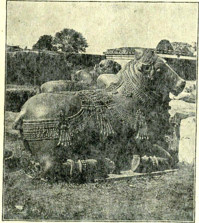
Photo: Hyderabad Archaeological Department, Shitab Khan of Warangal (Hyderabad Archaeological Series 9, Hirananda Sastri), 1932 · Public domain · before 1932 What to look for
- The sources do not agree on which building was the temple of Svayambhu. Most writers give the name to the great ruined temple inside the four gateways. Others give it to Sambhuni Gudi, a small temple facing the southern gateway.HRIDAY Warangal leafletEpigraphia Telanganica 2023Parabrahma Sastry 1975 (thesis)
- The 1900 survey calls the central building simply the great temple. The survey lists Sambhu Gudi separately, as a partly repaired temple with a closed hall and an open porch.ASI 1900
- Murthy identifies the big Nandi at Sambhuni Gudi as the bull that once faced Svayambhu Siva. Its hind part is worn by devotees who beat their heads on it. Its pedestal of red and black stone lay in the excavation pit.Gopalakrishna Murthy 1964
- An inscription of 2 October 1245 in the compound of Sambhuni Gudi records that Rudra of the Viriyala family gave thirty cows for a perpetual lamp to the god Svayambhu. The record shows that the shrine was in worship under Ganapati Deva.Epigraphia Telanganica 2023Parabrahma Sastry 1978From the page on Warangal Fort →
The map position is read from a written description, as on the plan of Warangal Fort on this website. The position is approximate.
4. Khasi Mahal
approximate position
About 100 m from stop 3 in a straight line. The road is longer. One or both of these positions are approximate.
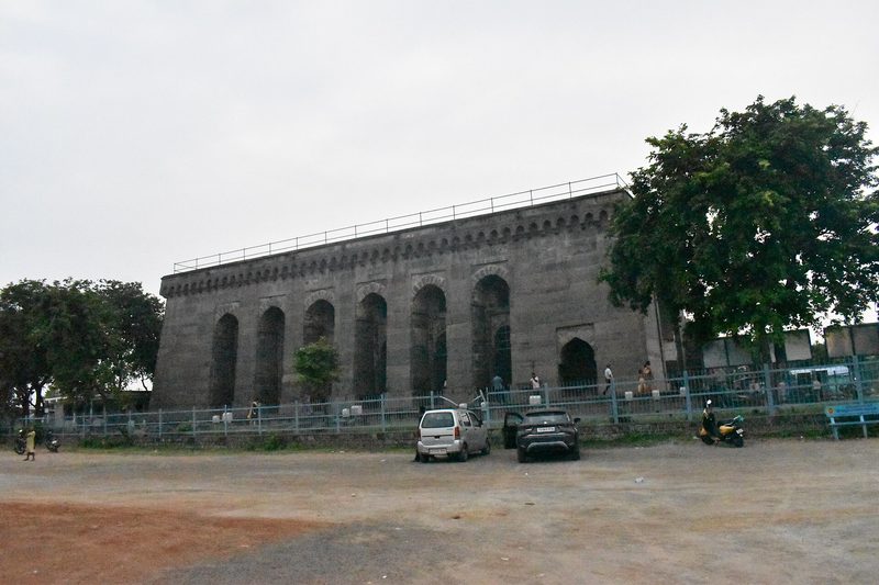
Photo: Pinakpani, via Wikimedia Commons · CC BY 4.0 What to look for
- The 1900 survey describes a very large and lofty building that faces north and has a single great hall.ASI 1900
- The hall stands on a platform 7.5 feet above the ground. The main entrance is a lofty arch on the north side. Arched openings pierce the long sides, and windows above them let in light and air.Nizam Archaeological Report 1925-26
- A bold arched cornice on stone brackets runs along the outside. The facing stones are laid in layers of alternate width.Nizam Archaeological Report 1925-26
- Hirananda Sastri credits the hall now called Khush Mahal, near the western gateway of the temple site, to Shitab Khan, who held Warangal around 1500. Phillip Wagoner dates the hall earlier, to the Delhi Sultanate.Hirananda Sastri 1932Wagoner 2017 (Encyclopaedia Iranica)From the page on Warangal Fort →
Condition recorded on this website: Standing.
5. The west gate of the stone wall· Warangal Fort
About 500 m from stop 4 in a straight line. The road is longer. One or both of these positions are approximate.
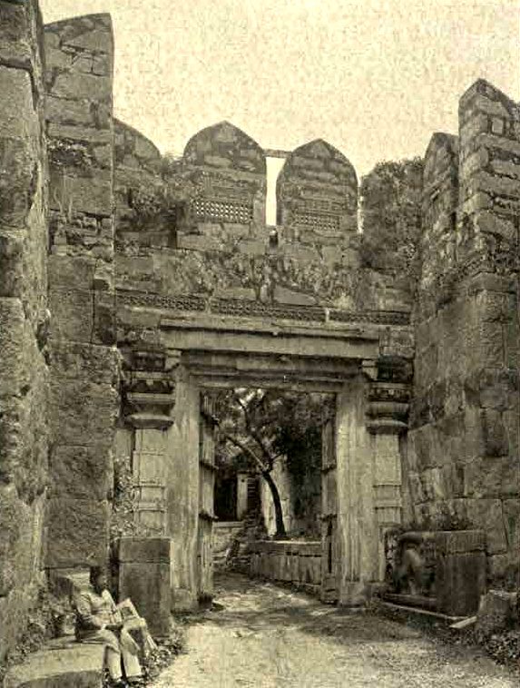
Photo: unknown photographer, Glimpses of the Nizam's Dominions (A. Claude Campbell), 1898 · Public domain · before 1898 What to look for
- Each gate of the stone wall follows the same pattern. An outer opening between two square towers leads into a long open courtyard, and a second opening leads into the fort.Deloche 2007
- Deloche describes the stone wall as 6 to 8 metres high and 6 to 7 metres thick, with 46 rectangular towers. A broad walkway runs along its top, and tiers of steps lead up to it all round the inside.Deloche 2007
- Two Gajapati records of 2 February 1460 survive at the fort gates. D. C. Sircar placed Ambira's record on the eastern gate and Raghudeva's on the western gate, locally called the fifth gate.Epigraphia Telanganica 2023From the page on Bandri Gateway →
- P. Sreenivasachar disagreed and placed Ambira's record on the stone gateway on the western side. The 1900 survey spells the king's name Kapilendra, as Ambira's record does. The Bandri gateway was probably the gate carrying Ambira's record.Epigraphia Telanganica 2023ASI 1900From the page on Bandri Gateway →
6. The west gate of the earthen wall· Warangal Fort
approximate position
About 500 m from stop 5 in a straight line. The road is longer. One or both of these positions are approximate.
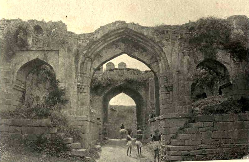
Photo: unknown photographer, Glimpses of the Nizam's Dominions (A. Claude Campbell), 1898 · Public domain · before 1898 What to look for
- The 1900 survey describes a great circular fort with an outer earthen wall and an inner masonry wall. The survey recorded four gates, one each on the north, south, east and west. Only the east and west gates were then in use.ASI 1900
- Later sources count a gate in each wall at every cardinal point, which makes eight in all. The HRIDAY leaflet describes the gates of the mud wall as later work in a Muslim style.HRIDAY Warangal leafletParabrahma Sastry 1978
- Amir Khusrau describes the siege of 1310. The outer wall was of mud, with a very deep ditch in front of it. After the outer wall fell, the attackers swam the ditch of the inner stone fort.Elliot & Dowson III
The map places this gate where the earthen wall meets the west, as on the plan of Warangal Fort on this website. The position is approximate.
7. Three-shrined temple in the mud wall· Warangal Fort
approximate position
About 900 m from stop 6 in a straight line. The road is longer. One or both of these positions are approximate.
What to look for
- A temple with three shrines stands between the stone and mud walls in the north-west quarter, nearly buried in the mud wall. All three of its shrines had been ransacked by 1900.ASI 1900
- The review for 1997-98 describes the temple as partly buried in the mud rampart, with three shrines facing north, south and east. The three-shrined temple of the 1900 survey was likewise a temple of three shrines, nearly buried in the mud wall.IAR 1997-98ASI 1900
- The 1997-98 excavation exposed the ruined brick towers over the central and southern shrines, plastered with lime and decorated in stucco. The review calls these towers of the bhumija type and says that the type is rarely seen in Kakatiya temples. The tower of the northern shrine was lost.IAR 1997-98
The map position is read from a written description, as on the plan of Warangal Fort on this website. The position is approximate.
8. Shivanagar Stepwell
approximate position
About 1.2 km from stop 7 in a straight line. The road is longer. One or both of these positions are approximate.
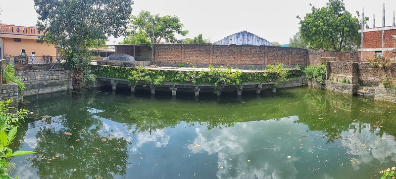
Photo: Torchtelangana, via Wikimedia Commons · CC BY-SA 4.0 · 2023 What to look for
- The Hans India gives the names of the stepwell as Metla Bavi and, locally, Anthasthulu Bavi. The report describes a square, multi-storeyed well of about 12 by 12 metres.The Hans India 2023
- The Deccan Chronicle of 2017 also records the names Digudu Bavi and Eetha Kolanu, and describes three storeys. The Deccan Chronicle of 2025 gives the size as 14 metres on each side.Deccan Chronicle 2017Deccan Chronicle 2025
- The historian Hari Sanath Kumar points to the way the number of pillars at each level decreases from the top to the bottom. He also notes that each layer rests on its pillars with iron rings.Deccan Chronicle 2017
- All three reports place the stepwell in the Kakatiya period, and the 2025 report calls it 800 years old. None of the reports gives evidence for the date, and no inscription or published survey records the well.Deccan Chronicle 2017The Hans India 2023Deccan Chronicle 2025
Condition recorded on this website: Restored in 2025 and open to the public.
The routes · 2
Hanamakonda and the road to the fort
The temples and hills of the early capital, then Mattewada and Kasibugga
8 stops · about 6.9 km in straight lines from the first stop to the last
At Hanamakonda, the Anumakonda of the inscriptions, high mud walls join a chain of hills into a fortress. Stone gateways lead through the walls.Rama Rao 1966
Gopalakrishna Murthy traces an old road from the Hanumakonda fort gate towards Warangal, with temples on either side.Gopalakrishna Murthy 1964
This route visits the temples and hills of Hanamakonda first. The route then turns south-east through Mattewada to Kasibugga, in the direction of Warangal Fort.
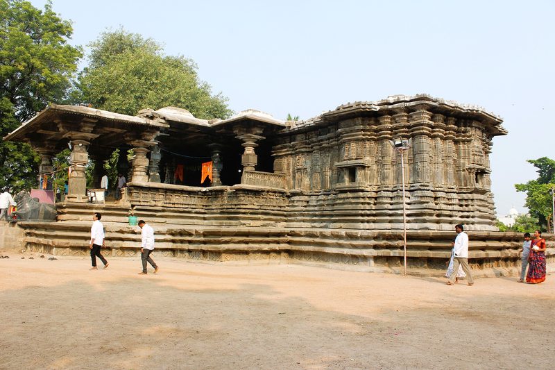
Photo: Ssriram mt, via Wikimedia Commons · CC BY-SA 4.0 What to look for
- The three shrines face different ways. Rudresvara (Shiva) is on the west, Vasudeva (Vishnu) on the north and Surya on the east.Rama Rao 1966
- The temple stands on a double platform with a star-shaped plan. The temple faces south.Rama Rao 1966
- A compound of low walls built of large stone blocks encloses the temple. The old main entrance is on the east, beside the inscribed granite pillar. A large well with steps stands in the north-east corner of the compound.Rama Rao 1966
- A large black stone Nandi faces the shrine.Rama Rao 1966
Condition recorded on this website: Standing and conserved. The Kalyana Mandapa was dismantled for reconstruction.
2. Aggalayya Gutta
About 600 m from stop 1 in a straight line. The road is longer.
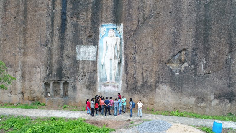
Photo: Torchtelangana, via Wikimedia Commons · CC BY-SA 4.0 What to look for
- The largest statue is a standing Tirthankara in a sunken panel on a sheer rock face that looks north. News reports give its height as 30 or 35 feet.Telangana Today, July 2021Deccan Chronicle 2018Telugu WikipediaTelangana360, 2024
- A second standing statue, about 13 feet high, is Parsvanatha. A snake with seven hoods rises over his head.Telangana Today, July 2021Wikimedia Commons descriptions
- A row of seven smaller standing Tirthankaras is carved in niches on a boulder of the hill. Two of them stand in front of the coils of a snake.Wikimedia Commons descriptionsTelugu Wikipedia
- The Kakatiya Urban Development Authority developed the hill for visitors under the HRIDAY scheme from about 2017. During this work the Parsvanatha relief was recut in fresh stone.Deccan Chronicle 2018Wikimedia Commons descriptions
Condition recorded on this website: Developed for visitors and in Jain worship. The paint has been removed from the large statue. The left hand of the large statue and some neighbouring reliefs show modern repair or new carving.
3. Padmakshi Temple
About 450 m from stop 2 in a straight line. The road is longer.
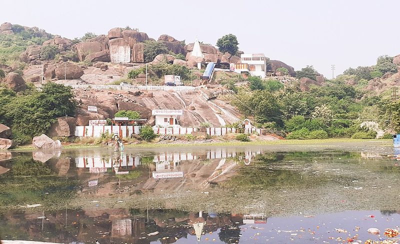
Photo: Ssriram mt, via Wikimedia Commons · CC BY-SA 4.0 What to look for
- A Kannada inscription on a granite pillar before the shrine is dated Monday, 24 December 1117. It records that Mailama, wife of Pergade Beta, built the Kadalalaya Basadi on the Anmakonda hill. Pergade Beta was a minister of Prola II, then a Western Chalukya feudatory.ASI 1900Epigraphia Indica IXEpigraphia Telanganica 2023
- Each face of the pillar bears a seated Jain ascetic in relief. The east face also shows a cow and calf, and the north face shows the sun and the moon.Epigraphia Indica IX
- The shrine has a garbhagriha and a small mandapa under a narrow, stepped, pyramidal vimana. Narrow steps lead up to it from a pond at the foot of the hill, the Padmakshi-gundam.Rama Rao 1966
- Reliefs on the rock inside show a Tirthankara with his yaksha and yakshi. The yakshi is now worshipped as Padmakshi. Gopalakrishna Murthy identifies the three sculptures as Parsvanatha, Dharanendra and Padmavati.Rama Rao 1966Gopalakrishna Murthy 1964
Condition recorded on this website: In worship as a Hindu shrine.
4. Anumakonda Fort
approximate position
About 350 m from stop 3 in a straight line. The road is longer. One or both of these positions are approximate.
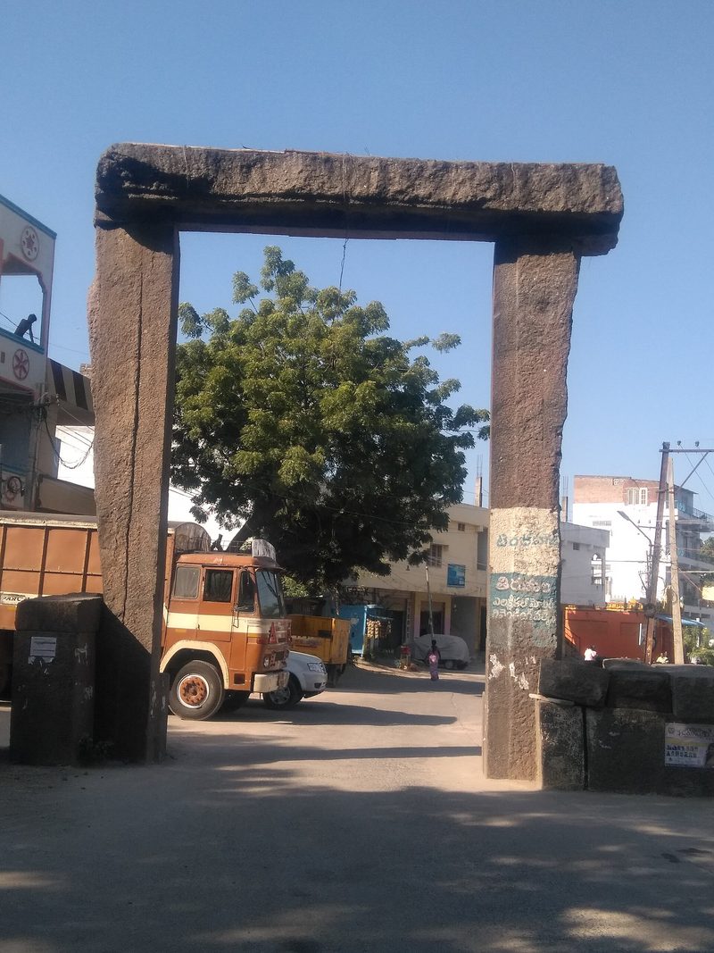
Photo: Adbh266, via Wikimedia Commons · CC BY-SA 3.0 What to look for
- A stone gateway leads into the citadel between two hills. A second gateway stands opposite it in another mud wall.Rama Rao 1966
- Rama Rao describes a wide gap in a chain of hills. High mud walls join two big hills and two small hillocks into a fortress.Rama Rao 1966
- Appanna Sastri describes a route by which the defenders could reach Orugallu unseen by enemies. The route entered by the great gate in front of the Padmakshi temple. It left through a large gateway behind the Siddhesvara temple.Appanna Sastri (ed.) 1934
- A large relief of Chamunda is carved on a boulder on the north side inside the fort.Gopalakrishna Murthy 1964
Condition recorded on this website: Remains of the walls and gateways survive, according to Parabrahma Sastry and Rama Rao.
5. Siddhesvara Temple
About 350 m from stop 4 in a straight line. The road is longer. One or both of these positions are approximate.
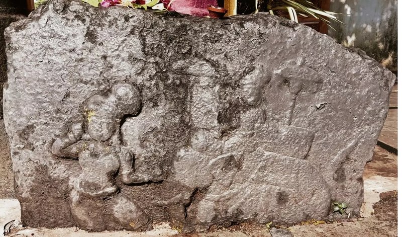
Photo: Samaleti Rohith, via Wikimedia Commons · CC BY-SA 4.0 What to look for
- Rama Rao places the temple inside the old citadel of Anmakonda. The citadel also contains the Padmakshi temple.Rama Rao 1966
- Gopalakrishna Murthy describes the pedestal of the Siddheswara linga as crude reddish-white granite. He attributes the pedestal to Beta II, who built the Betesvaram temple.Gopalakrishna Murthy 1964
- Gopalakrishna Murthy groups the Siddhesvara temple with early shrines that carry a stepped pyramidal sikhara.Gopalakrishna Murthy 1964
Condition recorded on this website: In worship. The sources record no dated inscription of the temple.
6. Bhadrakali Temple
About 1.1 km from stop 5 in a straight line. The road is longer.
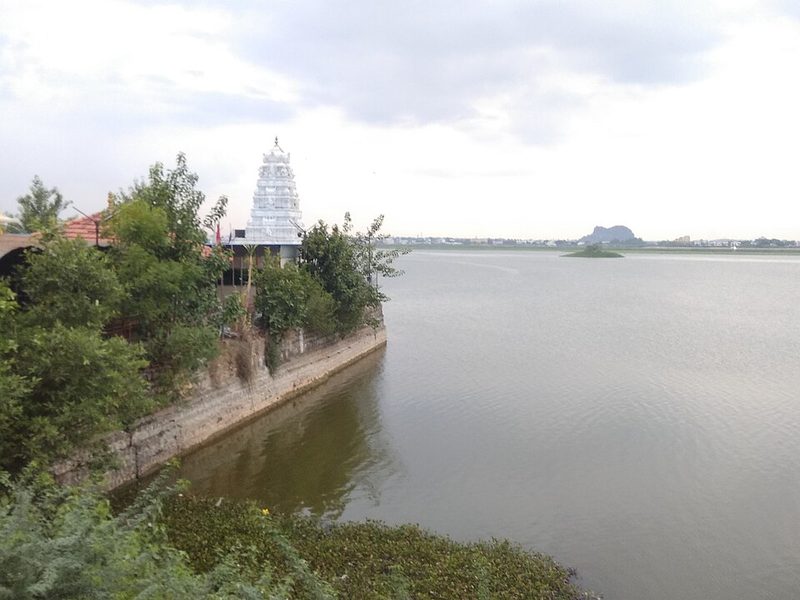
Photo: Harsha8398, via Wikimedia Commons · CC BY-SA 4.0 What to look for
- The temple stands on a hillock between Warangal and Hanamakonda. The stone goddess is seated, crowned and eight-armed, and holds weapons. The image is 2.7 metres high and 2.7 metres wide.District Census Handbook 1986
- Gopalakrishna Murthy describes the image as a large painted Chamunda in relief, with a human body stretched beneath her seat. He notes that the temple and the image have been repaired several times.Gopalakrishna Murthy 1964
- From that corpse seat, Gopalakrishna Murthy identifies the goddess as Kakatamma, the guardian goddess of the Kakatiyas. He reports a belief that the temple is due to Rudrama Devi.Gopalakrishna Murthy 1964
Condition recorded on this website: In worship. The temple has been repaired several times (1964).
7. Mattewada Temples
approximate position
About 2.3 km from stop 6 in a straight line. The road is longer. One or both of these positions are approximate.
Inked impression: Hyderabad Archaeological Department, A Corpus of Inscriptions in the Telingana Districts of H.E.H. the Nizam's Dominions, Part II (Hyderabad Archaeological Series 13), 1940, Plate 15 · Public domain · before 1940 What to look for
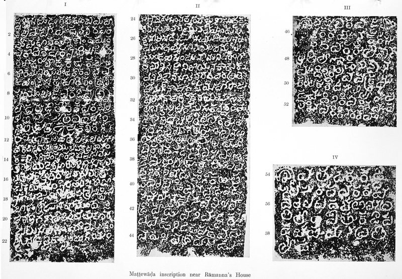
- Parabrahma Sastry writes in his thesis of 1975 that the market of the Kakatiya capital was called Mathiya. He places it between the old town of Anumakonda and the new town of the Orugallu fort.Parabrahma Sastry 1975 (thesis)
- Murthy writes that numerous old temples still stood on either side of the Mattewada road in his day. He adds that all the small temples on the road in Mattewada had been renovated over the centuries.Gopalakrishna Murthy 1964
- Murthy names the Ramalingesvara temple of Mattewada as one of the small temples around Warangal whose architraves echo those of the Swayambhu temple. The architrave above its doorway shows Brahma, Kumara, Siva and Ganapati dancing.Gopalakrishna Murthy 1964
Condition recorded on this website: Murthy wrote in 1964 that the small temples on the Mattewada road had been renovated over the centuries, while sculptural fragments lay under trees and in fields. The District Census Handbook of 1986 calls some old temples here dilapidated.
8. Ranganathaswamy Temple, Kasibugga
approximate position
About 1.8 km from stop 7 in a straight line. The road is longer. One or both of these positions are approximate.
What to look for
- The District Census Handbook of 1986 says that the temple was originally a Siva temple. Both Census volumes note that the image of Ranganathaswamy rests on a pedestal of the kind made for a Sivalinga. For this reason, the 1964 volume says, the linga is believed to have been replaced by the image after the decline of the Kakatiyas.Census 1961, Fairs and Festivals: WarangalDistrict Census Handbook 1986
- The 1964 volume adds that a small Siva temple stands beside the Ranganathaswamy temple, and that the Sivalinga is enshrined in it.Census 1961, Fairs and Festivals: Warangal
- To the north of the small Siva temple is a well called Kasi Bugga, which means the spring of Kasi. Local belief holds that the Ganga flows to it underground from Kasi, or Benares.Census 1961, Fairs and Festivals: Warangal
- The District Census Handbook of 1986 gives a different version. It places a small spring to the north of the temple itself and explains the name Kasibugga by it. It says that the present image was installed after the downfall of the Kakatiyas, and that a local chief built the temple as his wife desired.District Census Handbook 1986
Condition recorded on this website: In worship as a Ranganathaswamy temple in 1964, with a small Siva temple and the Kasi Bugga well beside it. The sources consulted give no recent description.
The routes · 3
East of Warangal: Ramappa and the great lakes
Katakshapur, Jakaram, Ghanpur, Ramappa, Laknavaram, Pakhal and Mogilicherla
8 stops · about 116 km in straight lines from the first stop to the last
The general Recherla Rudra built the Ramappa Temple at Palampet in 1213. The inscription of the temple says that he also built a town and the lake beside it.Parabrahma Sastry 1978Epigraphia Telanganica 2023
The temples at Katakshapur and Jakaram stand near the Warangal–Mulug road, on the way to Palampet.Rama Rao 1966
This route goes north-east to the temples at Ghanpur and Ramappa. The route returns past the great tanks of Laknavaram and Pakhal and the Ekavira temple at Mogilicherla.
The stops lie far apart, so please choose the stops that suit your visit.
1. Katakshapur Temples
approximate position
About 28 km from Thousand Pillar Temple in a straight line. The road is longer. One or both of these positions are approximate.
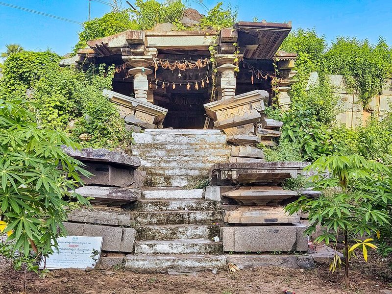
Photo: P. Madhusudan, via Wikimedia Commons · CC0 What to look for
- The temples stand outside Katachpur village, about a mile from the Warangal–Mulug road on the way to Palampet.Rama Rao 1966
- One temple faces east and the other faces south. Both are 54 feet square, alike in plan and construction, and ruined.Rama Rao 1966
- Each temple has a mandapa with a porch and three shrines on a high base. The walls are plain, built of large stone blocks, and the flat roofs have no vimanas. Gajalakshmi appears on the doorway lintels.Rama Rao 1966
- Two of the shrines hold lingas. The eastern shrine of the second temple holds a standing four-armed Vishnu, probably Chennakesava, with mutilated arms.Rama Rao 1966Gopalakrishna Murthy 1964
Condition recorded on this website: Ruined (1966).
2. Jakaram Temple
approximate position
About 10 km from stop 1 in a straight line. The road is longer. One or both of these positions are approximate.
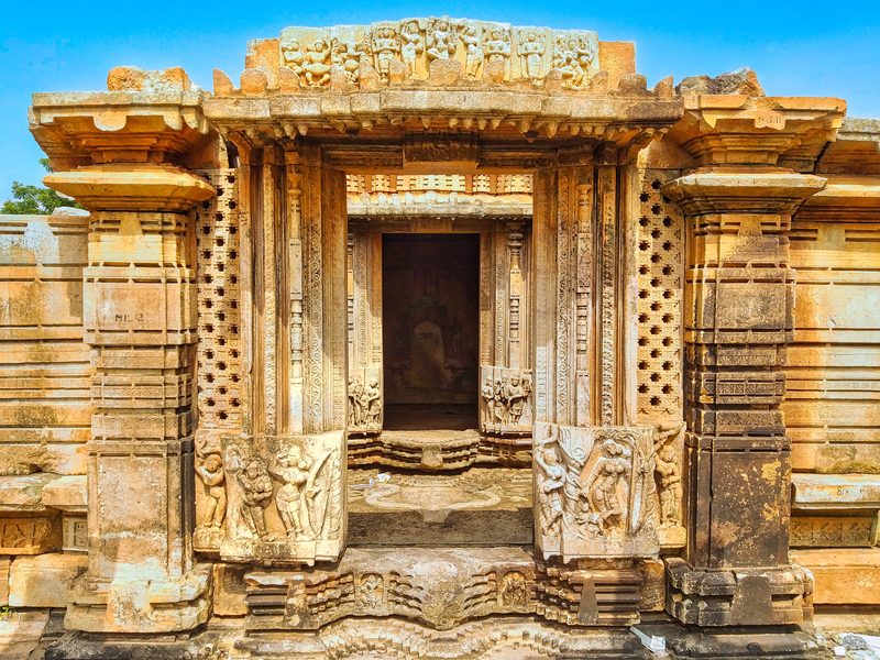
Photo: P. Madhusudan, via Wikimedia Commons · CC0 What to look for
- The temple stands about a furlong from the Warangal–Mulug road outside Jakaram, on a low mound among fields. It faces south.Rama Rao 1966
- The temple has a garbhagriha, an antarala and a mandapa with porches on three sides. Its walls are plain, built of large stone blocks, and its flat roof has no vimana.Rama Rao 1966
- The antarala jambs show a woman with a bow and arrow, attended by two others. Gopalakrishna Murthy reads the scene as a huntress removing a thorn from her foot.Gopalakrishna Murthy 1964
Condition recorded on this website: The image is missing, and the base is partly buried (1966).
3. Ghanpur Temple Complex
About 16 km from stop 2 in a straight line. The road is longer. One or both of these positions are approximate.
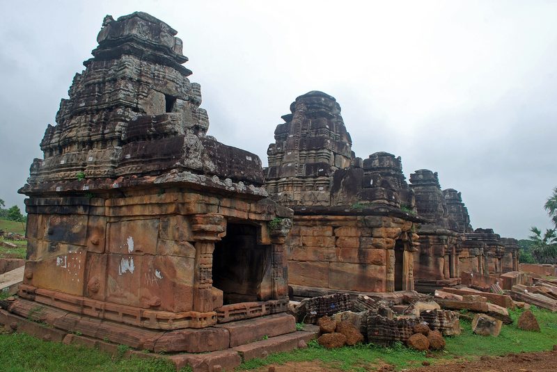
Photo: Rangan Datta Wiki, via Wikimedia Commons · CC BY-SA 4.0 What to look for
- The group has around twenty-two temples inside a double enclosure 260 feet square. The inner enclosure is built of huge stone blocks.Kore & Sudhakar 2017Rama Rao 1966
- Eight subsidiary shrines line the western wall, and a group of five shrines stands north of the main temple.Kore & Sudhakar 2017
- The antarala doorway of the main temple carries a carving of Siva Tandava and pierced jali work.Kore & Sudhakar 2017
- Reddy Gudi is a Siva temple at the other end of Ghanpur village. Reddy Gudi faces north.Rama Rao 1966Kore & Sudhakar 2017
Condition recorded on this website: Ruined but substantially standing. The roof of the main hall has fallen.
4. Ramappa Temple
About 9.5 km from stop 3 in a straight line. The road is longer.
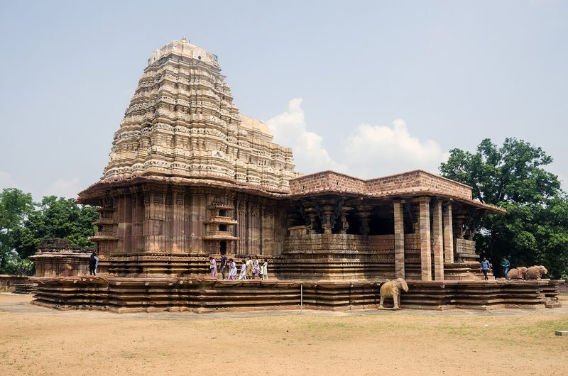
Photo: Rangan Datta Wiki, via Wikimedia Commons · CC BY-SA 4.0 What to look for
- Recherla Rudra, a general of Ganapati Deva, built the temple in 1213 in his new town of Atukuru. Atukuru is now Palampet.Barnett 1919Parabrahma Sastry 1978UNESCO dossier 2017
- Bracket sculptures of women, called madanikas, spring from the outer pillars of the porches to support the overhanging cornice. The sculptures are almost life-size and carved in dolerite.ASI 1900UNESCO dossier 2017Rama Rao 1966
- The tower over the shrine is built of bricks that are light enough to float on water.UNESCO dossier 2017ASI 1900
- The Kateshwara temple stands north of the main temple on its own high platform. The Kameshwara temple, now called the Kalyana Mandapa, stands to the south on a star-shaped platform of its own.UNESCO dossier 2017
Condition recorded on this website: UNESCO inscribed the temple on the World Heritage List in 2021 as Kakatiya Rudreshwara (Ramappa) Temple, Telangana.
5. Ramappa Lake
About 2.3 km from stop 4 in a straight line. The road is longer.
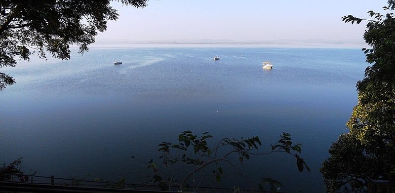
Photo: Thirumal Prasad Patil, via Wikimedia Commons · CC BY-SA 4.0 What to look for
- The inscription of 1213 in the temple courtyard says that Recherla Rudra built a city and a pond. The pond “stands like an ocean” and “looks like a mirror for that city”.Epigraphia Telanganica 2023
- An earthen dam about 2,000 feet long and 56 feet high closes a semicircular chain of hills.Rama Rao 1966
- The UNESCO dossier places Ramappa Cheruvu south-west of the temple, below the forest hills. The temple stands on the downstream side of the tank.UNESCO dossier 2017
- The dossier states that the Voger channel runs from the lake past the western side of the temple to water the surrounding fields.UNESCO dossier 2017
Condition recorded on this website: In use (1981).
6. Laknavaram Lake
About 18 km from stop 5 in a straight line. The road is longer.
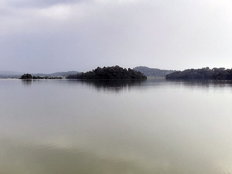
Photo: Rangan Datta Wiki, via Wikimedia Commons · CC BY-SA 4.0 What to look for
- Three narrow valleys were each closed with a short bund to form the lake. Its catchment is about 195 square kilometres, and it irrigates about 5,260 hectares. Its surplus water ultimately joins the Godavari.District Census Handbook 1986
- Parabrahma Sastry calls Laknavaram another big tank of the Kakatiya period. Like the Bayyaram tank and Pakala Lake, it is fed by streams that flow off a large plateau.Parabrahma Sastry 1978
- The sources consulted contain no inscription that gives the builder or the date of the lake.Parabrahma Sastry 1978Epigraphia Telanganica 2023
Condition recorded on this website: In use for irrigation (1981).
7. Pakhal Lake
About 24 km from stop 6 in a straight line. The road is longer.
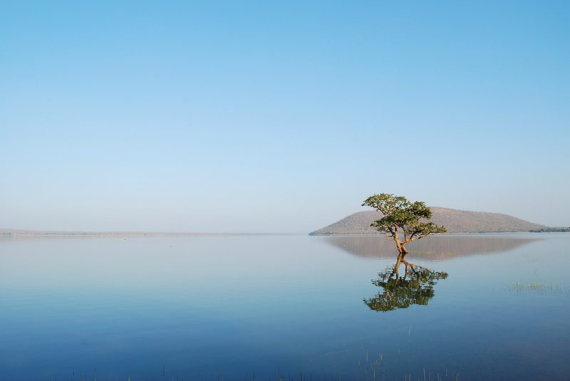
Photo: Alosh Bennett, via Wikimedia Commons · CC BY 2.0 What to look for
- The dam is about two thousand yards long and holds back nearly thirteen square miles of water. The lake measures roughly 8,000 by 6,000 yards.Imperial Gazetteer 1909
- Other sources give different lengths for the dam. Parabrahma Sastry and the 1900 survey give about one mile, and the 1976 Warangal Gazetteer gives 1,219 metres.Parabrahma Sastry 1978ASI 1900Warangal District Gazetteer 1976
- A small pavilion called the chabutra of Shitab Khan stood at the centre of the bund.Imperial Gazetteer 1909ASI 1900
- A stone pillar on the bund carries an illegible inscription. Tradition says that it records the builder as Raja Khaldya.ASI 1900
Condition recorded on this website: In use. Restoration under the Mission Kakatiya programme.
8. Ekavira Temple, Mogilicherla
approximate position
About 35 km from stop 7 in a straight line. The road is longer. One or both of these positions are approximate.
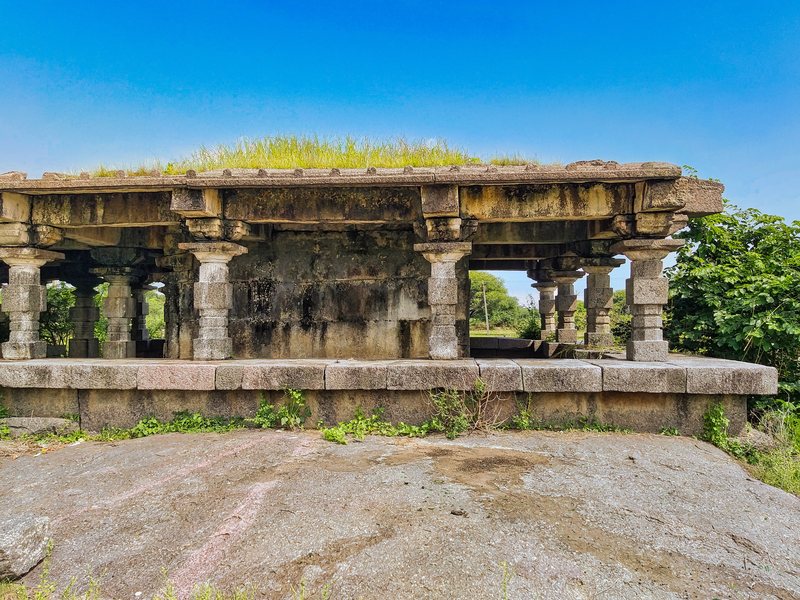
Photo: P. Madhusudan, via Wikimedia Commons · CC0 · 2021 What to look for
- Gopalakrishna Murthy describes the Ekavira temple as a simple one, with a sanctum and an antechamber. A parapet wall runs around it, with a raised stone seat along its inner side.Gopalakrishna Murthy 1964
- In his description, pillars seem to rise from the parapet wall at regular intervals. The roof covers the temple and also the circumambulatory path inside the line of pillars. Murthy notes the same kind of roof in the Chalukyan temples at Alampur.Gopalakrishna Murthy 1964
- Gopalakrishna Murthy saw a crude Bhairava carved in low relief near the temple, and a very recent image meant to portray Ekavira.Gopalakrishna Murthy 1964
Condition recorded on this website: In ruins by 1962, with its annual festival discontinued. Photographs of 2021 show the pillared hall and the square sanctum still standing on bare rock, overgrown, with numbers painted on the pillars and beams.
Other sites near Warangal
These sites lie away from the three routes. The distances are straight lines from the Swayambhu temple in Warangal Fort.
- Dargah of Afzal Shah Biyabani, Kazipet
About 9.1 km from Swayambhu Temple, Warangal Fort in a straight line. The road is longer. One or both of these positions are approximate.
The dargah lies west of Hanamakonda, away from the line of the second route. The sources record two old inscribed pillars in the dargah, one of them with a Kakatiya inscription.
- Mallikarjuna Temple, Inavolu
About 12 km from Swayambhu Temple, Warangal Fort in a straight line. The road is longer.
The temple lies south-west of Warangal, away from the eastern route. Photographs of 2021 show its stone gateways and its pillared hall standing.
- Kondaparthi Temples
About 9 km from Swayambhu Temple, Warangal Fort in a straight line. The road is longer. One or both of these positions are approximate.
The village lies south-west of Warangal, near Inavolu. Kondaparthi was the home of the Malyala generals, and the ruins of their temples remain there.
The routes were drawn from the pages of this website in October 2026. If you find an error, please use the correction form linked below.