Warangal Fort
Warangal Fort was the Kakatiya capital at Orugallu. The great circular fort has an outer earthen wall and an inner masonry wall, with a gate on each of its four sides: north, south, east and west. The Swayambhu temple, the shrine of the dynasty’s tutelary god, stood at its centre.
- Period
- Kakatiya, late 12th century to 1323 CE
- Materials
- Earthen ramparts, and a stone wall of large, irregular granite blocks
- Location
- 17.9572° N, 79.6144° E
Source of the position: Wikidata Q7968796
- Condition
- The four temple gateways and the fort walls survive. The temple itself is largely gone.
The plan draws the earthen wall, the stone wall, the gates of the stone wall and the water bodies from the OpenStreetMap trace, so their shapes and sizes are true to the ground. The temple precinct is drawn at the size that the 1900 survey gives. The positions of the smaller monuments are read from written descriptions and are approximate.
Plan compiled from:OpenStreetMapDeloche 2007Aerial view of Warangal Fort (blog image)UNESCO additional information 2019ASI 1900Haig 1907Parabrahma Sastry 1978Rama Rao 1966HRIDAY Warangal leafletNizam’s Archaeological Reports 1920–31Hirananda Sastri 1932Imperial Gazetteer 1909
Drawn for this site from the sources listed · CC BY-SA 4.0
Warangal had three walls, one inside another. The stone wall and the earthen wall survive, and the map draws them from the OpenStreetMap trace. Deloche describes a third wall of earth and rubble, which formed a circle about 12.2 km across. Only traces of this wall survive, so the map draws it as a circle around the fort. Hanamakonda, the earlier capital, lies about 7 km north-west of the fort, near the line of the outermost wall.
Plan compiled from:OpenStreetMapDeloche 2007Aerial view of Warangal Fort (blog image)
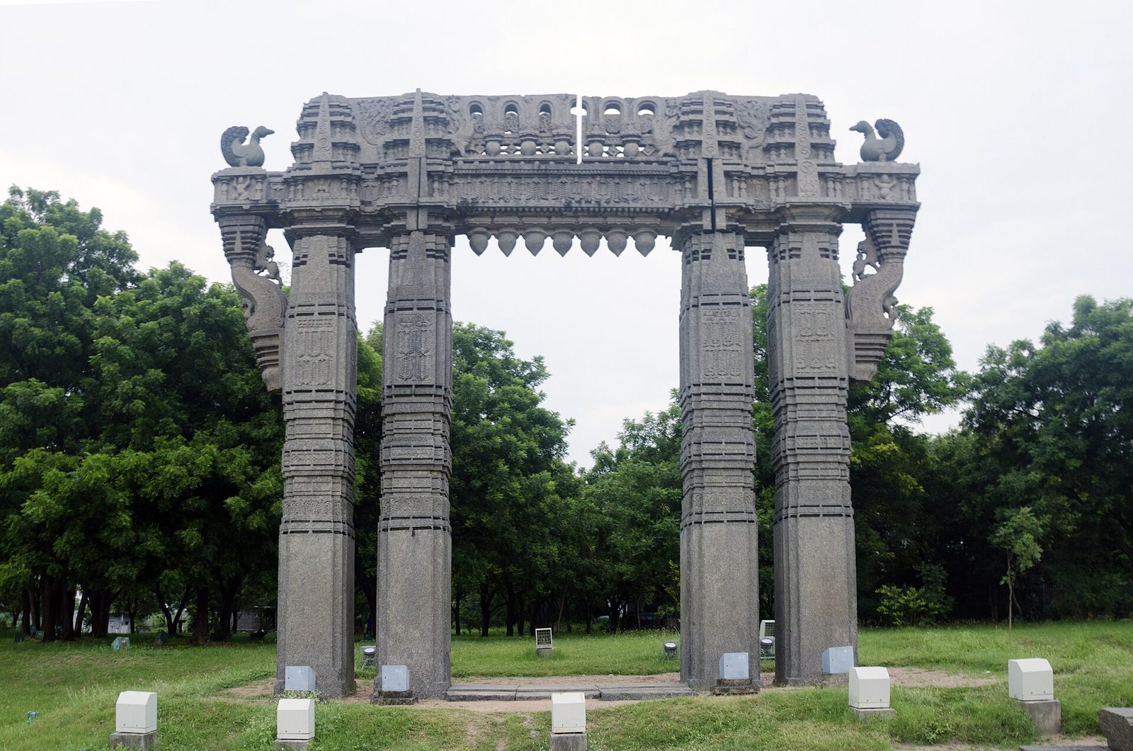
One of the four keerthi thoranam that survive from the Swayambhu temple: paired pillars carry a carved lintel with birds at the corners. The gateways stand 480 feet apart north to south and 433 feet east to west.
Photo: Rangan Datta Wiki, via Wikimedia Commons · CC BY-SA 4.0

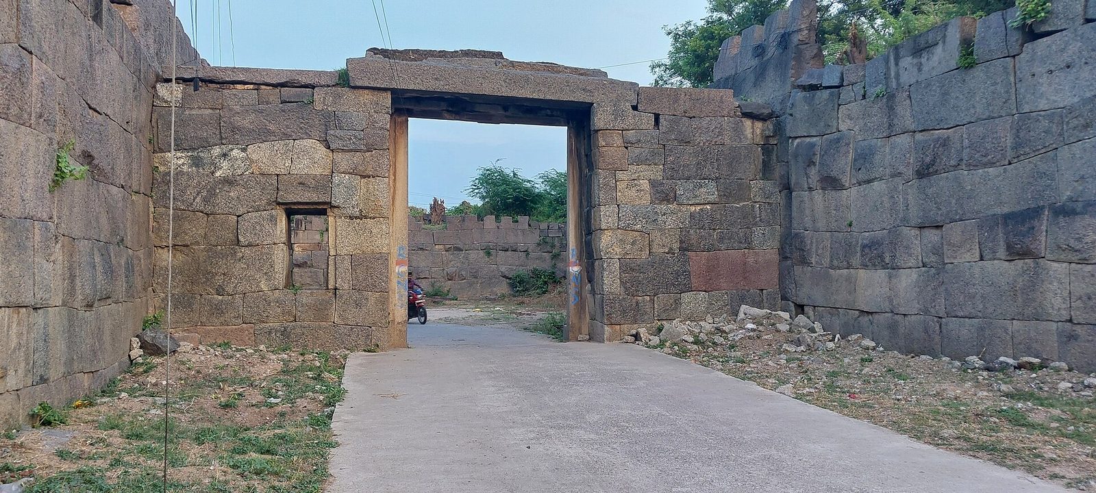
A road passes through a trabeate (flat-lintelled) gateway in the masonry wall of the fort. The flanking walls are built of large dressed blocks.

Detail
- The 1900 survey describes a great circular fort with an outer earthen wall and an inner masonry wall. The survey recorded four gates, one each on the north, south, east and west. Only the east and west gates were then in use.ASI 1900
- Later sources count a gate in each wall at every cardinal point, which makes eight in all. The HRIDAY leaflet describes the gates of the mud wall as later work in a Muslim style.HRIDAY Warangal leafletParabrahma Sastry 1978
- Parabrahma Sastry states that Rudra Deva began building the walls around the Swayambhu temple and that Ganapati Deva completed it.Parabrahma Sastry 1978
- The Imperial Gazetteer tells it differently. In its version Ganapati Deva began the stone wall, and Rudrama Devi completed it and added the outer mud wall.Imperial Gazetteer 1909
- Haig gives the circumference of the stone wall as four miles and 630 yards. He gives the diameter of the area inside the earthen wall as about two miles.Haig 1907
- The Swayambhu temple occupied the centre of the fort. Its four great gateways, the Kakatiya Kala Thoranams, still stand.ASI 1900
- Gopalakrishna Murthy calls the four toranas the culmination of a long effort to build an imposing gateway. In his view the effort began with the stone arches of the Hanumakonda fort.Gopalakrishna Murthy 1964
- The north and south gateways of the temple stand 480 feet apart, and the east and west gateways stand 433 feet apart. The 1900 survey compared the intact temple only with the Rudra Mala at Siddhpur in Gujarat.ASI 1900
- Excavations in 1934–35 showed that the temple faced west and was never finished.Nizam’s Archaeological Reports 1920–31
- Traces of a third, outermost earthen wall survived in 1900 between Narsimallugudium and Timmapuram, about four miles south-west of Warangal. A threshold slab there measured 19 feet long.ASI 1900Haig 1907
- Shitab Khan, who held Warangal around 1500, built the hall now called Khush Mahal near the western gateway of the temple site.Hirananda Sastri 1932
- Lanja gudi, a temple with three shrines, stands between the stone and mud walls in the north-west quarter. All three of its shrines had been ransacked by 1900.ASI 1900
- On the OpenStreetMap trace, the earthen wall measures about 7.77 km round and 2.47 km across. The stone wall is about 4.07 km round and 1.3 km across.OpenStreetMap
- Deloche describes three enclosures. The outermost is a wall of earth and rubble, which formed a circle about 12.2 km across. Only traces of it survive.Deloche 2007
- Deloche gives the earthen wall a height of 14 to 17 metres and a wide, deep ditch. Deloche cites the Siddhesvara Charitra for 8 gates and 16 small side gates in this wall. The Siddhesvara Charitra is not a text of the 13th century. Its editor, K. Lakshmi Ranjanam, dates the poet Kase Sarvappa to about 1600.Deloche 2007Siddhesvara Charitra (ed. 1960)
- Deloche describes the stone wall as 6 to 8 metres high and 6 to 7 metres thick, with 46 rectangular towers. A broad walkway runs along its top, and tiers of steps lead up to it all round the inside.Deloche 2007
- Each gate of the stone wall follows the same pattern. An outer opening between two square towers leads into a long open courtyard, and a second opening leads into the fort.Deloche 2007
- Earlier writers give larger numbers for the stone wall. Deloche gives 6 km round, and Haig gives four miles and 630 yards.Deloche 2007Haig 1907
- Amir Khusrau describes the siege of 1310. The outer wall was of mud, with a very deep ditch in front of it. After the outer wall fell, the attackers swam the ditch of the inner stone fort.Elliot & Dowson III
- Amir Khusrau gives the whole circuit of the wall in 1310 as 12,546 yards in Elliot and Dowson's translation. Each army division held 1,200 yards of the siege line.Elliot & Dowson III
- India's 2019 reply to UNESCO states that the Swayambhu temple was destroyed in the Tughlaq invasion. According to that reply, its stones and even its foundations were reused in Khush Mahal, Konda Masjid, a horse stable, an ammunition house and the fort walls.UNESCO additional information 2019
- The sources disagree on whether the temple was finished. The 1934–35 excavations suggested it was never completed. India's 2019 reply to UNESCO states that it was completed in 1261 but gives no evidence.Nizam’s Archaeological Reports 1920–31UNESCO additional information 2019
- The Ramappa dossier follows Eaton and Wagoner on the walls. In that view Warangal was already a capital under Rudra Deva, and Ganapati Deva rebuilt the inner wall with huge blocks of dressed granite.UNESCO dossier 2017
- India proposed the Swayambhu temple and its toranas for the World Heritage List in 2014. The final nomination dropped them because the temple is a ruin and its remains need full reassessment.UNESCO dossier 2017
- Parabrahma Sastry describes three walls. The outermost wall was a bank of mud about ten feet high that ran round the villages of Karparti, Kazipet and Anumakonda, but it was broken in many places. He gives the earthen wall of the fort a height of about 20 feet.Parabrahma Sastry 1978Parabrahma Sastry 1975 (thesis)
- An inscription of 2 October 1245 in the compound of Sambhuni Gudi records that Rudra of the Viriyala family gave thirty cows for a perpetual lamp to the god Svayambhu. The record shows that the shrine was in worship under Ganapati Deva.Epigraphia Telanganica 2023Parabrahma Sastry 1978
- Parabrahma Sastry describes the floor of the central chamber of the Svayambhu temple as a single polished slab, 16 feet square and 2 feet thick. He argues that the western hall and the four toranas are later than the eastern part, because the toranas do not line up with the main temple.Parabrahma Sastry 1978Parabrahma Sastry 1975 (thesis)
- Several quarters of Orugallu were named after towns that Rudra Deva conquered. Parabrahma Sastry gives Panugamti-vada, named after Panugallu, and Nagara, named after the town of Dommaraja.Parabrahma Sastry 1978Parabrahma Sastry 1975 (thesis)Talbot 2001
- Parabrahma Sastry reports Sanskrit verses naming the scholar Nrisimharshi on the Ekasila hill inside the fort and on one of the great stone gateways. One verse on the hill blesses Vira-Rudra, that is Pratapa Rudra.Parabrahma Sastry 1981 (Telugu)
- A Sanskrit poem of 62 verses about a Siddha couple is cut on a hill outside the village of Ursu near the fort. The poem names its author as Narasimharshi, son of the royal preceptor Visvesvara. Parabrahma Sastry published it in 1968 under the title Siddhodvaha.Parabrahma Sastry 1981 (Telugu)Epigraphia Telanganica 2023
- The Siddhesvara Charitra credits the walls to Rudrama Devi. In the poem she completes the unfinished stone fort, or kalukota, and builds an earth fort, or bhumikota, for her people. The poem also places a third wall, the puttakota, between these two forts.Siddhesvara Charitra (ed. 1960)
- In the Siddhesvara Charitra the earth fort has eight gates and sixteen small side gates. The puttakota and the stone fort each have four gates and eight small side gates. The poem adds moats filled with water and steps along the inside of the stone wall.Siddhesvara Charitra (ed. 1960)
Historical photographs
These photographs were published a century or more ago. They show the monument as it stood before later repair and restoration.
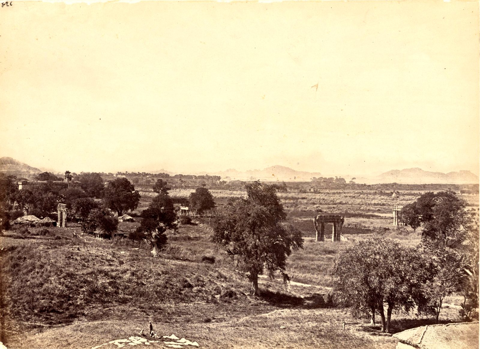
Photographed ca. 1850-1886
This view from a hill in Warangal Fort shows open fields with scattered trees. Stone gateways and pillars stand alone among the fields. The photograph dates from about 1850 to 1886.
Photo: unknown photographer, James Fergusson collection, Boston Public Library, via Digital Commonwealth · Public domain
_from_hill_in_Warangal_Fort_-_DPLA_-_4416d84a3897ccdc16239d00e0c5be90.jpg)
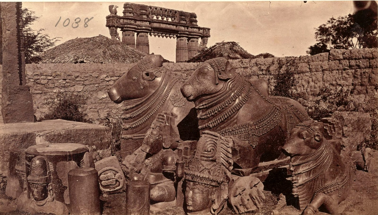
Photographed ca. 1850-1886
Two large carved stone Nandi bulls lie among broken carved stones at Warangal. A carved stone gateway rises behind the wall. The photograph dates from about 1850 to 1886.
Photo: unknown photographer, James Fergusson collection, Boston Public Library, via Digital Commonwealth · Public domain

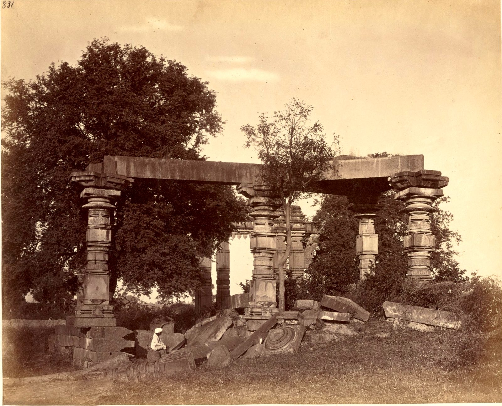
Photographed ca. 1850-1886
Carved stone pillars and a broken beam stand among trees at Warangal. Fallen carved blocks lie at their feet. The photograph dates from about 1850 to 1886.
Photo: unknown photographer, James Fergusson collection, Boston Public Library, via Digital Commonwealth · Public domain

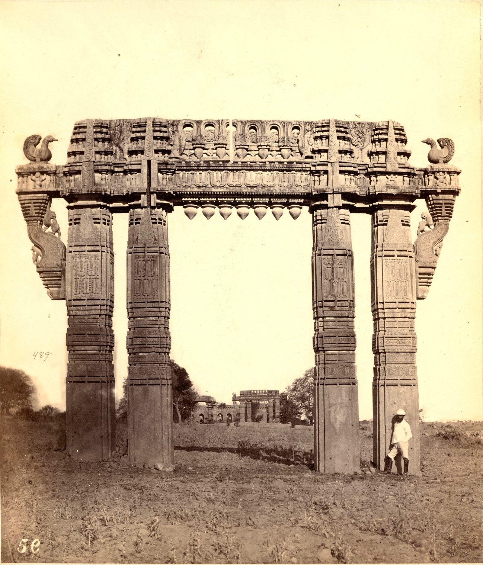
Photographed ca. 1850-1876
This photograph shows one of the carved stone gateways of Warangal Fort in open ground. A long arched building is visible through the gateway. The Boston Public Library dates the photograph to about 1850 to 1876.
Photo: unknown photographer, James Fergusson collection, Boston Public Library, via Digital Commonwealth · Public domain

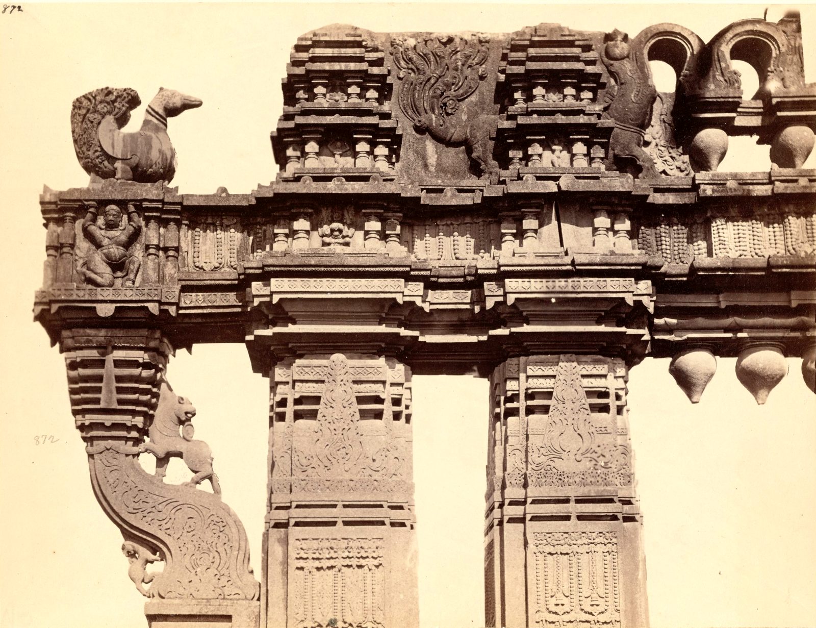
Photographed ca. 1850-1886
This close view shows the carved top of a Warangal Fort gateway. A stone swan sits on the end of the beam, and a rearing animal is carved on the bracket below. The photograph dates from about 1850 to 1886.
Photo: unknown photographer, James Fergusson collection, Boston Public Library, via Digital Commonwealth · Public domain

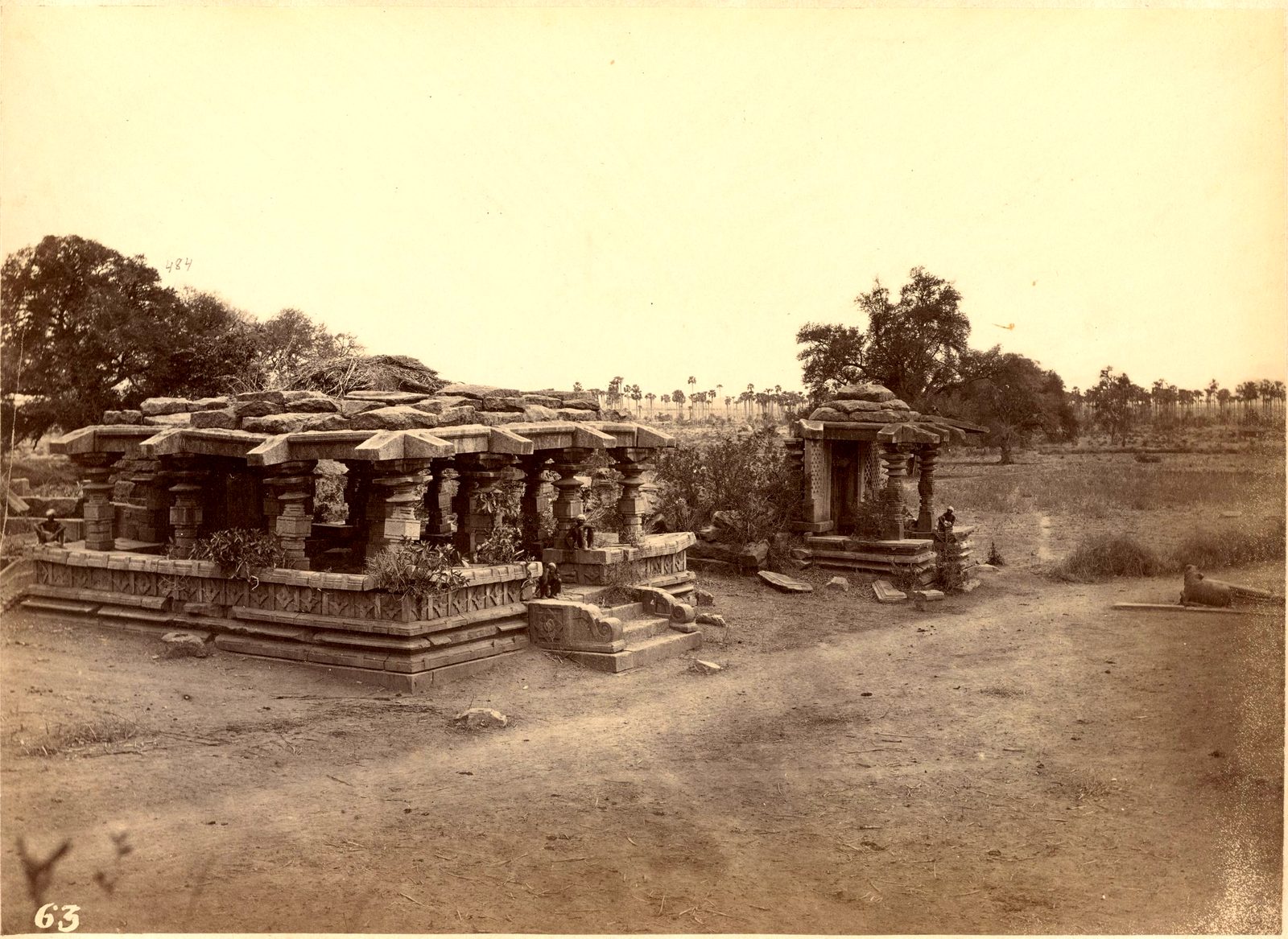
Photographed ca. 1850-1886
The Boston Public Library catalogue names this building a ruined temple at Warangal Fort. Small trees grow on its broken roof. The photograph dates from about 1850 to 1886.
Photo: unknown photographer, James Fergusson collection, Boston Public Library, via Digital Commonwealth · Public domain

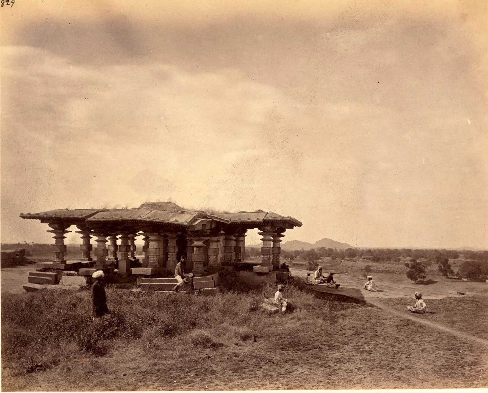
Photographed ca. 1850-1886
This flat-roofed stone pavilion stands in open grassland inside Warangal Fort. Several people sit on the ground nearby. The photograph dates from about 1850 to 1886.
Photo: unknown photographer, James Fergusson collection, Boston Public Library, via Digital Commonwealth · Public domain
_Warangal_Fort_-_DPLA_-_24bbf0f959bd7b3d2f54bbcc8567c35d.jpg)
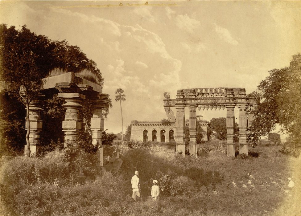
Photographed 1875
The gateway and temple ruins at Warangal photographed in the 1870s: a keerthi thorana stands at right amid scrub, with a ruined pillared structure at left and an arcaded building in the distance.
Photo: unknown photographer, published 1875 (Lee-Warner Collection, British Library), via Wikimedia Commons · Public domain

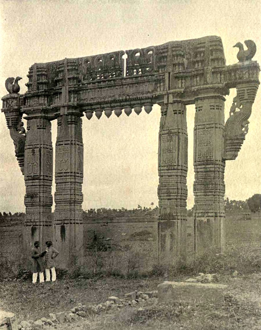
Photographed before 1898
This photograph shows one of the four carved stone gateways at Warangal Fort before 1898. The gateway stands alone in open fields with no wall or fence around it. Campbell's book calls it the Gate of Victory.
Photo: unknown photographer, Glimpses of the Nizam's Dominions (A. Claude Campbell), 1898 · Public domain
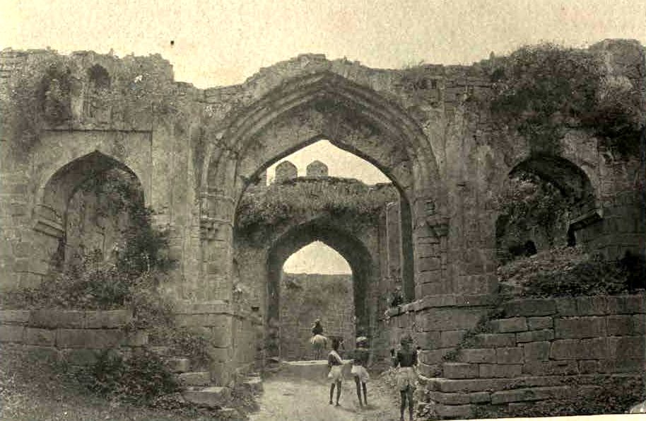
Photographed before 1898
Campbell's book names this ruined gateway the Hyderabad Gate. The same book places this gate on the west side of the outer earth wall of Warangal Fort. Plants grow on the walls in this photograph from before 1898.
Photo: unknown photographer, Glimpses of the Nizam's Dominions (A. Claude Campbell), 1898 · Public domain
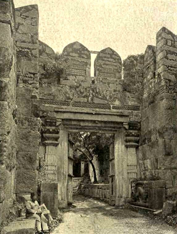
Photographed before 1898
Campbell's book calls this the inner western gate of Warangal Fort. A flat stone doorway stands between high stone walls with pointed parapets. The photograph was published in 1898.
Photo: unknown photographer, Glimpses of the Nizam's Dominions (A. Claude Campbell), 1898 · Public domain
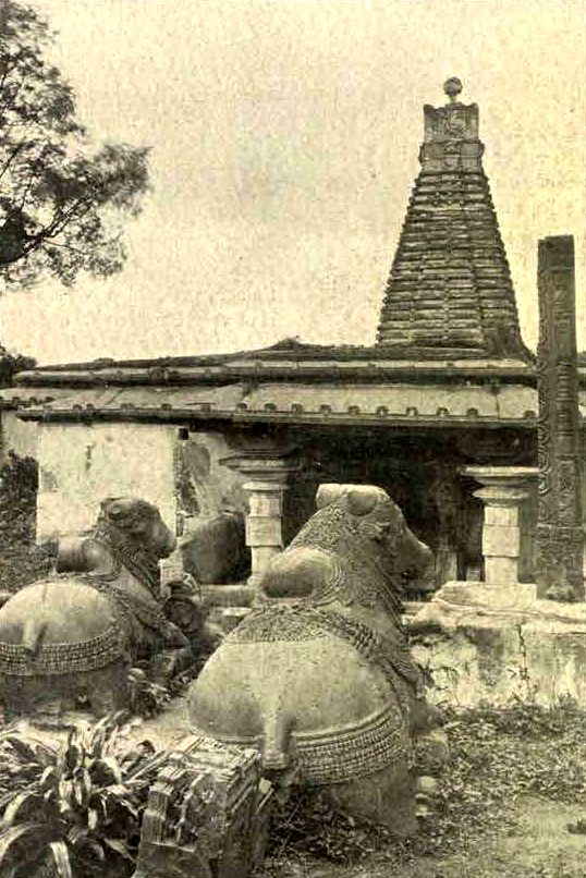
Photographed before 1898
Campbell's book calls this building the half-buried temple of Warangal. The book says that three carved stone bulls lie opposite this temple of Mahadeva. The photograph was published in 1898.
Photo: unknown photographer, Glimpses of the Nizam's Dominions (A. Claude Campbell), 1898 · Public domain
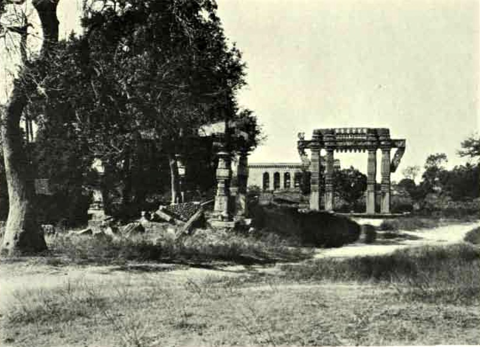
Photographed before 1928
The report for 1925-26 names this view the ruins of the old temple in Warangal Fort. Broken pillars stand under trees, and a carved stone gateway stands nearby. The report was published in 1928.
Photo: Hyderabad Archaeological Department, Annual Report of the Archaeological Department of H.E.H. the Nizam's Dominions for 1925-26, 1928 · Public domain
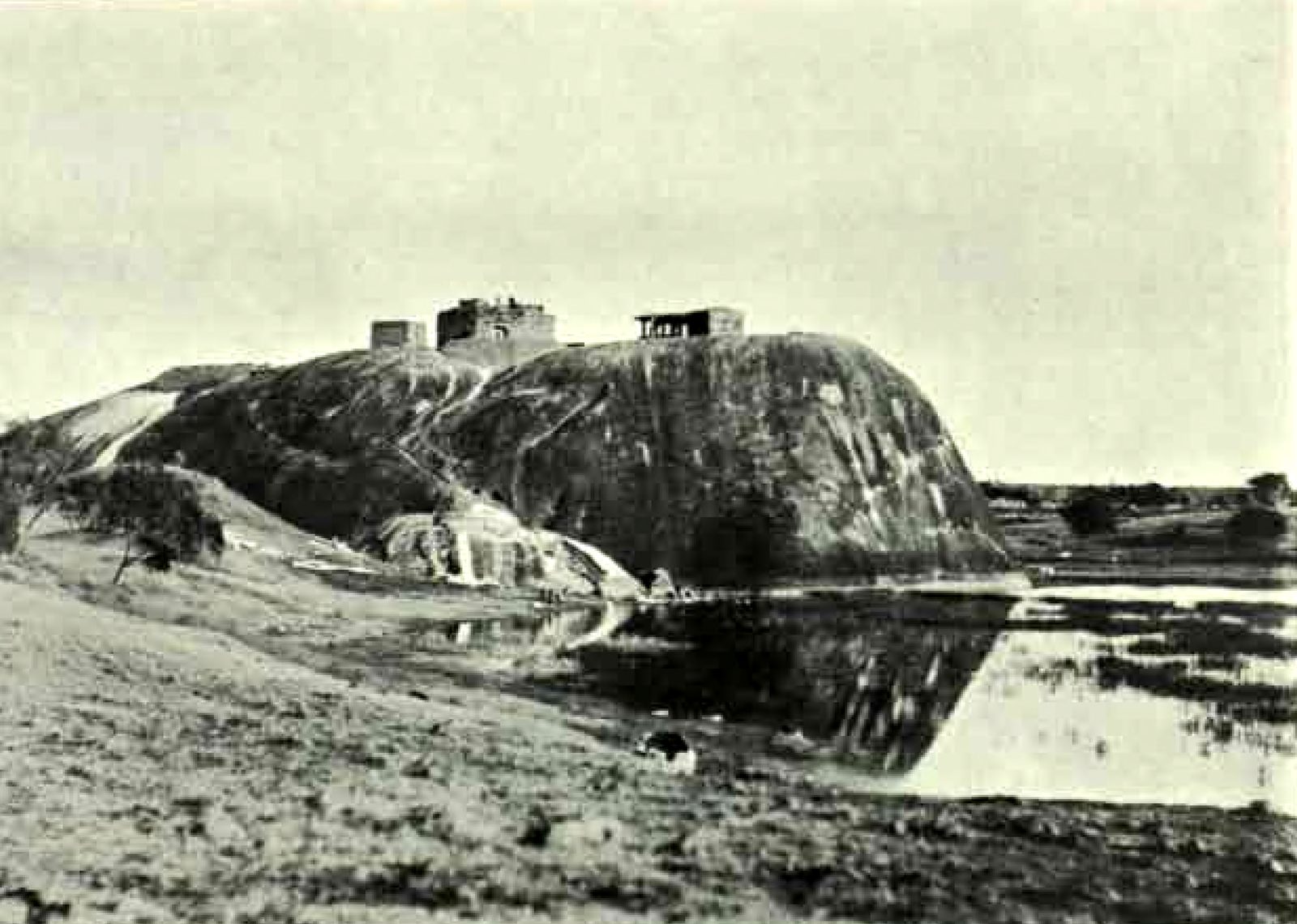
Photographed before 1928
The report for 1925-26 calls this rock Orukkal, the One Rock, of Warangal Fort. Small buildings stand on its top, and water lies at its foot. The report was published in 1928.
Photo: Hyderabad Archaeological Department, Annual Report of the Archaeological Department of H.E.H. the Nizam's Dominions for 1925-26, 1928 · Public domain
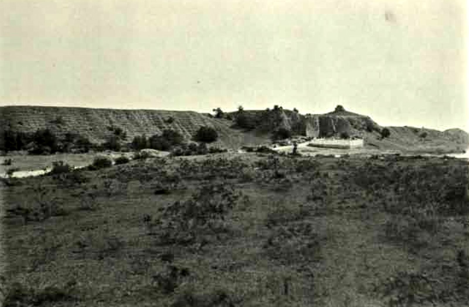
Photographed before 1928
The report for 1925-26 identifies this long earth bank as the old mud wall of Warangal Fort. The report dates the wall to the Hindu period. The report was published in 1928.
Photo: Hyderabad Archaeological Department, Annual Report of the Archaeological Department of H.E.H. the Nizam's Dominions for 1925-26, 1928 · Public domain
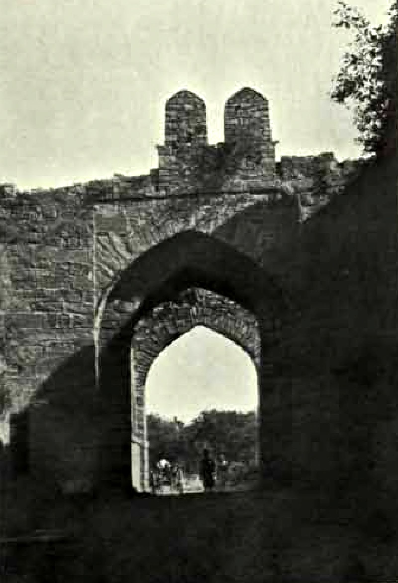
Photographed before 1928
The report for 1925-26 shows this gateway of Warangal Fort and dates it to the Muslim period. Two pointed parapets stand above the arches. The report was published in 1928.
Photo: Hyderabad Archaeological Department, Annual Report of the Archaeological Department of H.E.H. the Nizam's Dominions for 1925-26, 1928 · Public domain
Also recorded as
- Orugallu
- Orugolu
- Orrugallu
- Warangal
- Oruganti
- Ekasilanagaram
- Ekashilanagar
- Yeksilanagar
- Varankol
- Akshalinagar
- Sultanpur
Sources
- ASI 1900
- Deloche 2007
- Elliot & Dowson III
- Epigraphia Telanganica 2023
- Haig 1907
- Hirananda Sastri 1932
- HRIDAY Warangal leaflet
- Imperial Gazetteer 1909
- Nizam’s Archaeological Reports 1920–31
- OpenStreetMap
- Parabrahma Sastry 1981 (Telugu)
- Parabrahma Sastry 1978
- Parabrahma Sastry 1975 (thesis)
- Gopalakrishna Murthy 1964
- Siddhesvara Charitra (ed. 1960)
- Talbot 2001
- UNESCO dossier 2017
- UNESCO additional information 2019